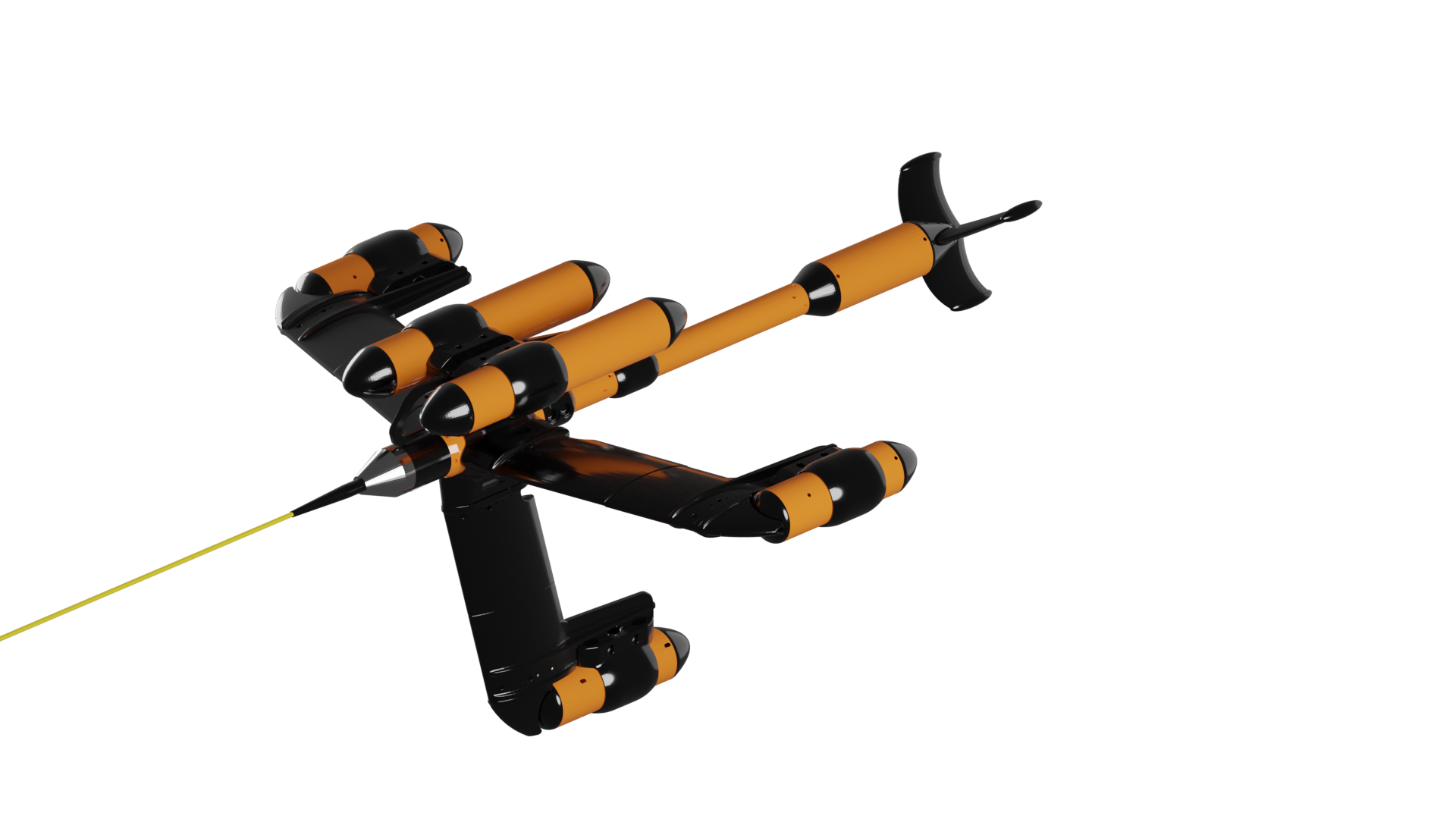
SeaQuest2
Get To The Point Faster.

Gradient Data
SeaQuest measures the gradients in all three directions simultaneously, and computes the total gradient, which is invariant of heading and orientation. No matter how your heading changes, no information is lost.
Horizontal gradiometers, on the other hand, can only measure the gradient in one axis (direction).
This means that whenever the heading or tilt of a 1-axis gradiometer changes, so does the direction of the measured gradient, making it more challenging to capture consistent line data.
Analytic Signal Mapping
Analytic Signal data suppresses geology and enhances small nearby targets, enabling you to see more of what you want to see, while suppressing what you don’t want to see. Single-axis gradiometers and arrays can only do this in one of three possible directions. Since SeaQuest measures the complete 3-dimensional gradient, it enhances signals from small targets uniformly, regardless of their geometry or position in space. BAM software (included with SeaQuest) allows you to visualise SQ data.
BAM software (included with SeaQuest) allows you to visualize SQ data.
Magnetometer System Comparison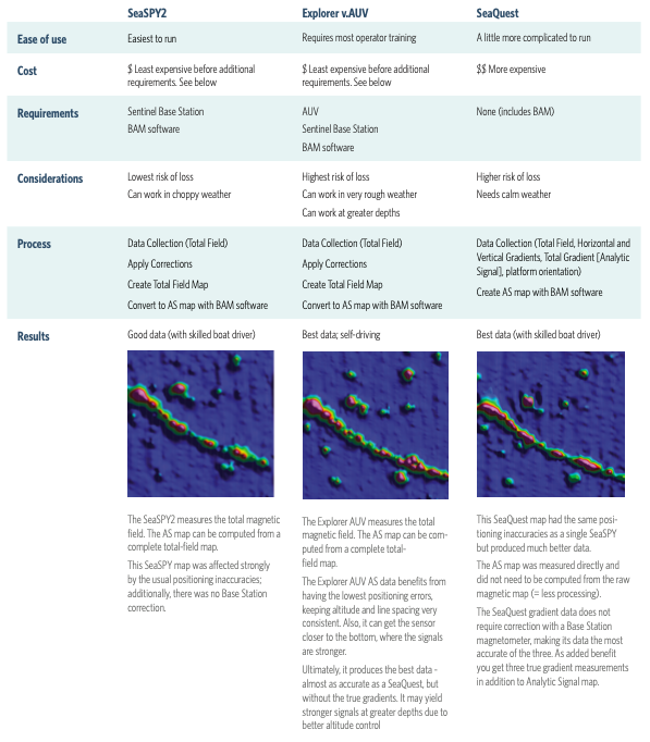
Features at a Glance
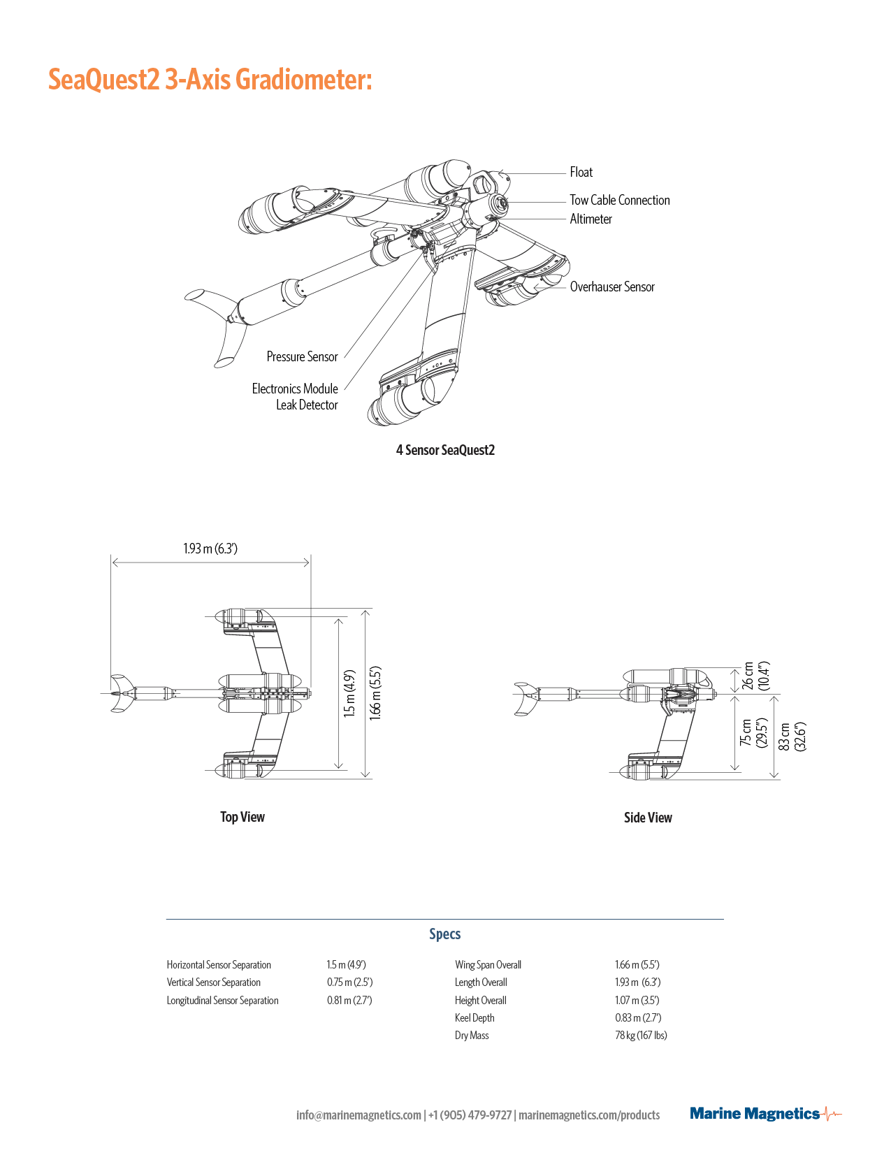
- Auxiliary sensors include: 3-axis IMU with gyro, leak detector in E/M, pressure sensor, altimeter
- Entirely non magnetic construction. All aluminum and fiberglass
- 300m depth rating
SeaQuest Is Ideal For
- UXO and mine detection
- Cable and pipeline tracking
- Environmental survey
- Archaeology
Update the transceiver firmware yourself to capitalize on our newest feature releases and critical updates.
Get BOB Survey Software
Easily plan, configure, execute, and analyze your survey – free and native for all our magnetometers. Learn more
To discuss whether SeaQuest is the perfect fit for your application, contact Gina Lopez:
gina.lopez@marinemagnetics.com
+1 (619) 655-0279