-
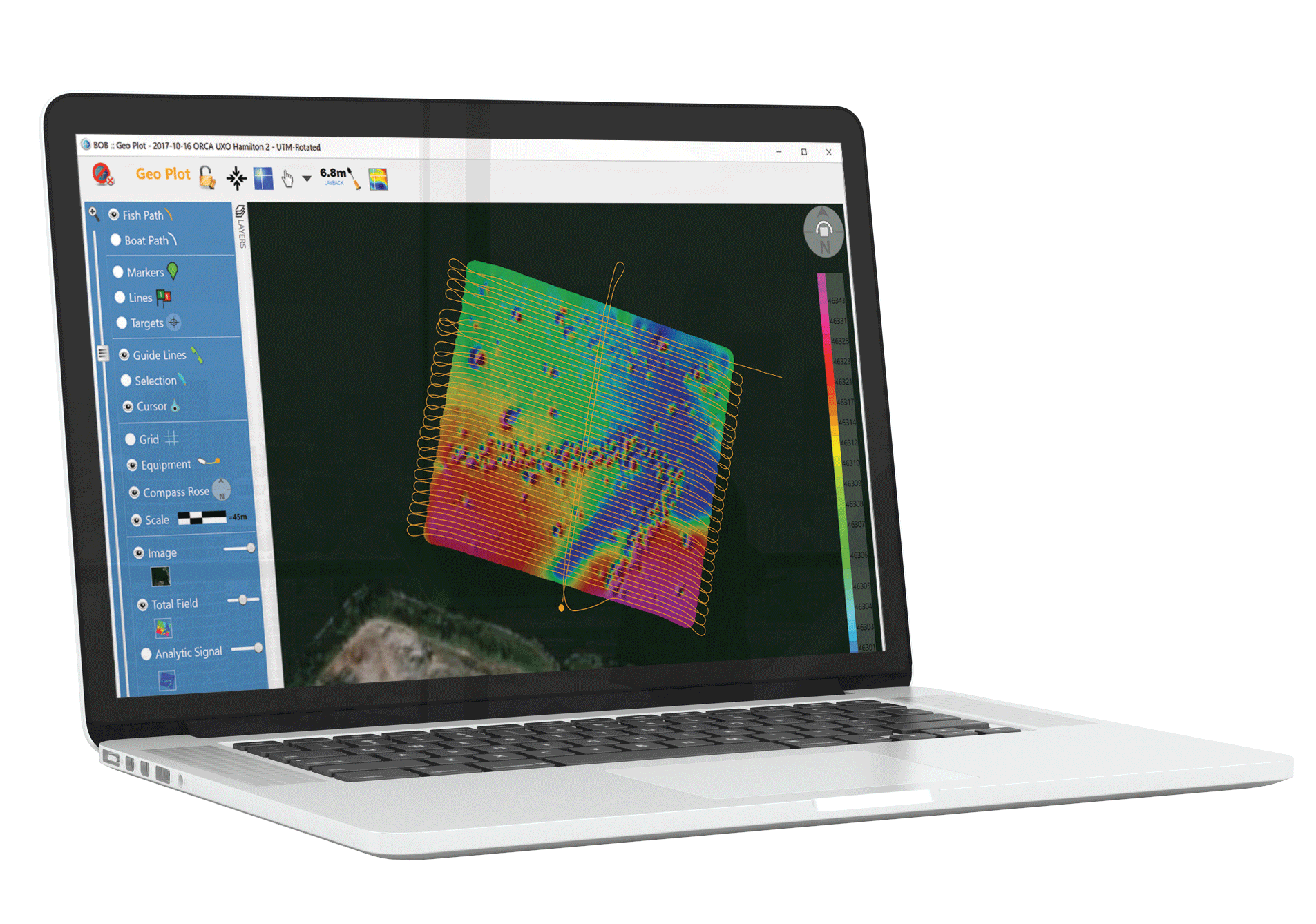
Extend BOB Functionality

- Create Total Field and Analytic Signal maps from your survey data
- Mark targets on the map or the Profile Plot, label them, and see statistics to refine your analysis.
- Dive confidently armed with a list of location targets and sizes
- Export maps as GeoTIFF. Grids can be exported numerically as Grid Exchange Format (GXF)
-
Get BAM
Request a trial license and get information on pricing and applications. -
Call Us
To discuss whether BAM is the perfect fit for your application, please contact Gina Lopez: gina.lopez@marinemagnetics.com +1 (619) 655-0179
Workflow
-


1. Eliminate Diurnal Variation
Subtle and unpredictable daily changes in Earth’s magnetic field can obscure survey data or even render it unusable. Base Station Correction compensates for this effect. Read more about ‘Base Station Correction’ on the BOB product page.
-
2. Correct for Heading Bias
Heading Bias Correction removes ‘corrugation’ between lines surveyed in opposite directions. The resulting distortion, usually caused by the magnetometer being too close to the boat, is visible throughout the map.
-
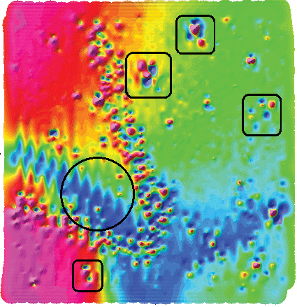
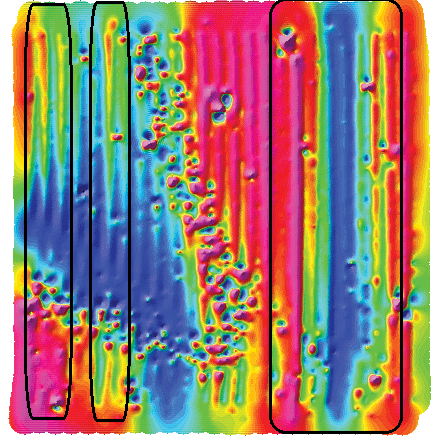
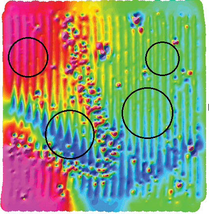
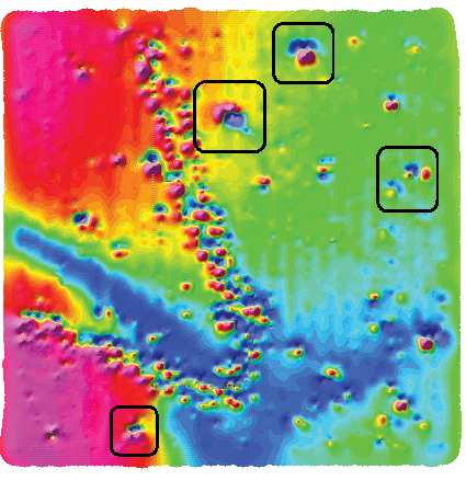
3. Eliminate Layback (Lag)
Layback Correction eliminates alignment issues between adjacent survey lines (the jagged features highlighted with a circle). Before Layback Correction, the anomalies (indicated in the boxes) look like multiple targets. After adjusting for Layback, the anomalies present as single targets (see the next step).
-
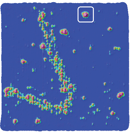
4. Corrected Total Field Map Reveals Anomalies
Corrections for systematic errors applied, anomalies are evident. It’s time to analyze them.
-
5. Transform to Analytic Signal Map
Analytic Signal Transform eliminates distracting gradual changes caused by distant geologic sources and emphasizes near-surface targets. The transformation in data clarity is stark (and exciting).
-
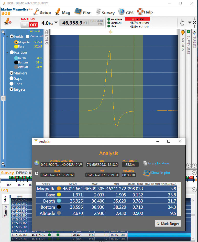
6. Choose Targets to Analyze
Click on anomalies to reveal basic analysis parameters and mark targets with the (cross-hair) icon.