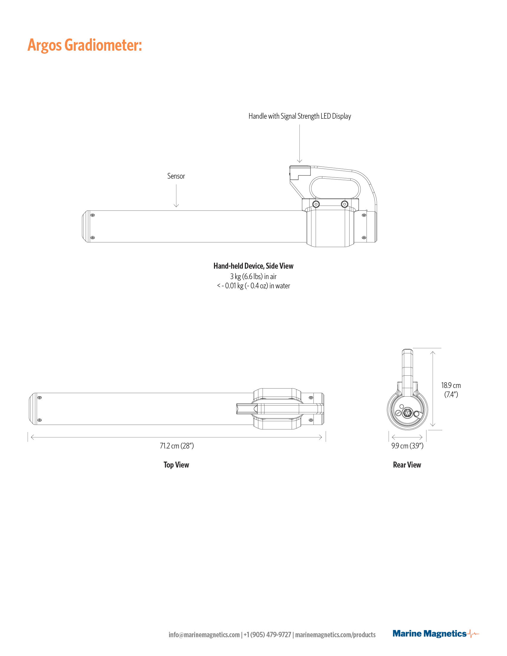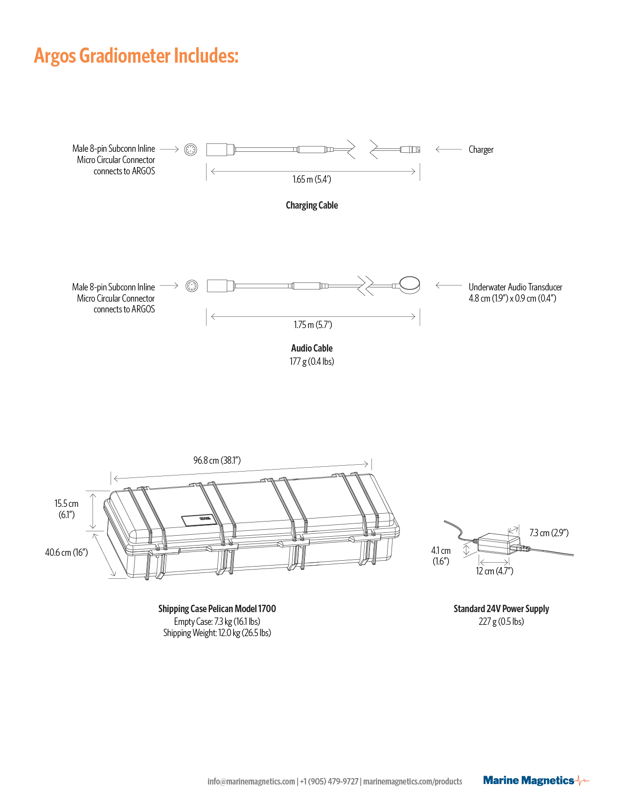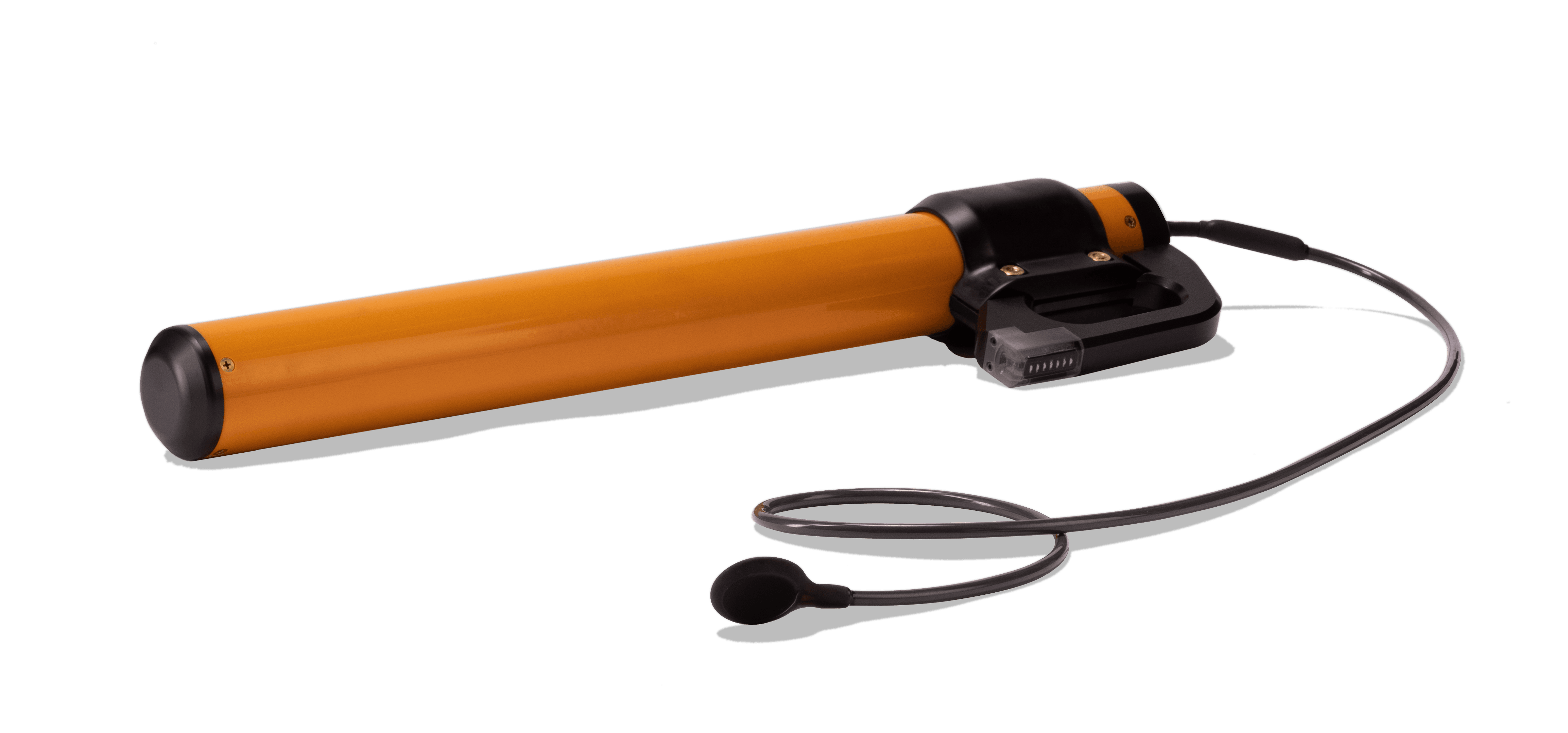
Argos
Argos in the Field: Anchor Discovered in 2019

Magnetic Map. Raw data collected by a boat-towed magnetometer survey reveals complex anomaly shapes that can be difficult to interpret and identify where source objects are located.
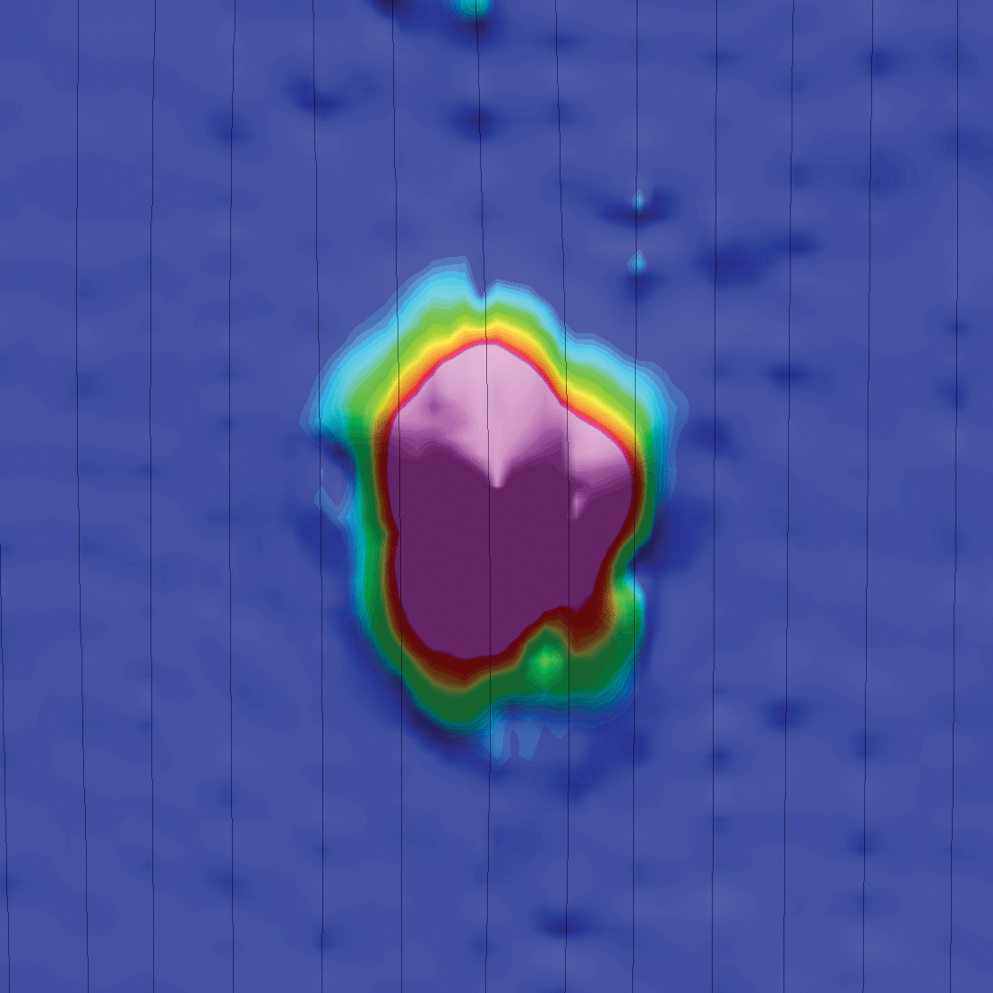
Gradient Map. The computed Analytic Signal or Total Gradient of the same area illustrates a clearly identified target region, but in a region that may be many meters in diameter.
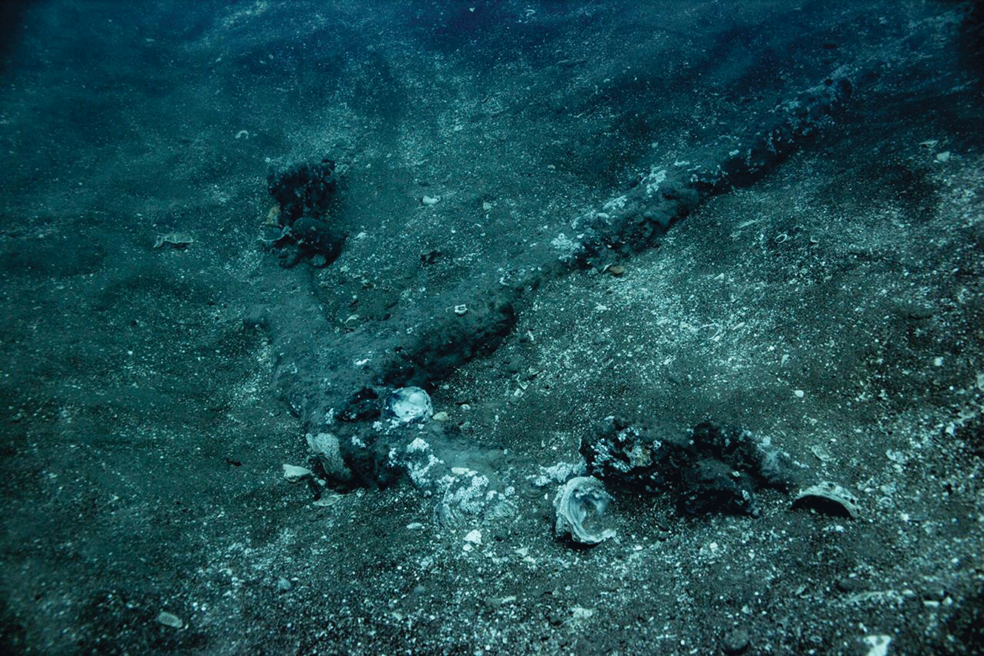
Discovery with Argos. Discovery with Argos. The anchors that created the anomalies above were found in minutes by Argos. The anchor pictured was entirely buried; this image shows it post-excavation.
Above: Dr. Christopher Horrell & Dr. Frederick Hanselmann use Argos to search for artifacts from the lost fleet of Hernan Cortes in Mexico. Photo credit: Jonathan Kingston. Download additional footage.